onX just took the digital mapping system to the next level with the launch of onX Hunt.
Technology is giving hunters the edge every year on becoming better and more efficient hunters. Some oppose technology while others are embracing it.
Sophisticated technology, like the kind used by onX has been a staple in western hunters for years now, and has become very helpful nationwide.
As a public land hunter in the northeast, I couldn't have been happier when I found the onX map software. I initially fell in love with it because it outlined property lines with information on the landowner, and clearly told me whether I was on public or nearing private land.
A simple click on the property, and I had the contact address of the landowner, his or her name, and some general information on the property, all at my disposal. This was extremely helpful in gaining access to land-locked public lands, gaining permission to hunt private property, and overall understanding who owns what when it comes to hunting locations.
The biggest part was that it saved me countless hours of digging up tax maps and contacting locals to get information. onX has done all the footwork, and now I can just browse, then take meaningful action.
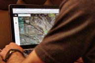
onX has just released their newest flagship product, onX Hunt. They took the original onX maps software and completely revamped it for the hunting population. Extremely user friend, onX Hunt represents the best available outdoor recreational mapping technology.
It includes several new features, like historic wildfire and timber cut layers to understand animal movement, custom waypoints, 24k topo maps, and a whole lot more. The advances in onX Hunt will literally transform how hunters experience the outdoors.
Some of the new features include:
onX's New Topo Basemap: onX's 20-person GIS team has spent more than five years compiling every trail and 2-track in the United States, and they will will continue to update the map each year. Hill shading, contours, and geographic features have been combined to help users better orient themselves.
Boone and Crockett Records: (Expected Update: soon) In a collaboration with Boone and Crockett, this layer provides detailed information on trophy records by species and county for all 50 states.
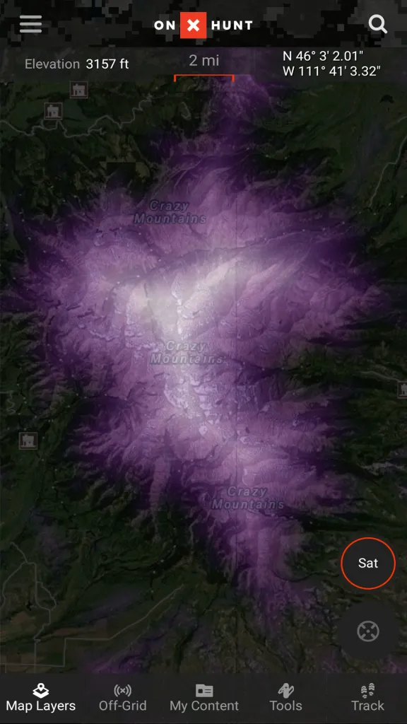
Randy Newberg's Roadless Layer: onX continues their long standing relationship with Randy Newberg in creation of this layer for those hunters who want to go deeper into the backcountry. This heat map highlights areas that are the furthest distance from roads.
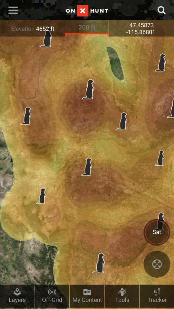
Prairie Dog Layer: (Expected Update: soon) onX spent five months pouring over satellite imagery to create the most comprehensive map of existing prairie dog towns in the US-over 16,000 in total.
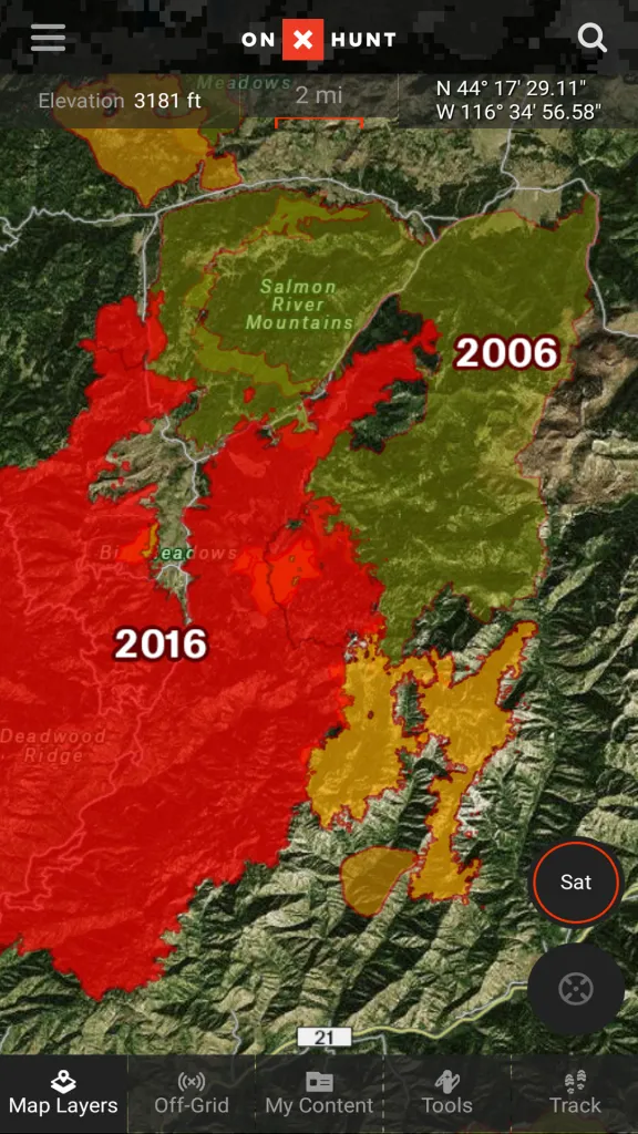
Historic Wildfires Layer: Hunters have known for years that animals will enter recently burned forests, especially as new growth emerges. This layer presents areas that have been hit by wildfires, including the fires' names, year of the fire, and the number of acres burned.
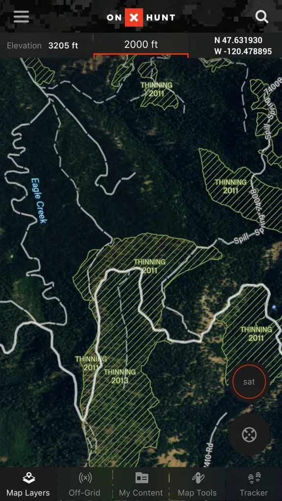
USFS Timber Cuts: This layer is perfect for hunters looking for clear cuts or thinned areas of the forest. It displays logging operations on National Forest Land from 2002-2017.
As a public land hunter, these features get me super excited. The new feature I'm looking forward to the most is Randy Newberg's Roadless Layer. This will give me an idea as to where the furthest distance from roads are. I like this feature because I like to get way off the road to do my hunting. Now if only everyone else ignores this clearly awesome addition...
Last year I used onX to find a spot that was land-locked by four miles of property frontage. It showed a small strip of public land access between two properties that otherwise would have made for an eight-mile hike to the area. We ended up four miles back from the nearest road, and I successfully harvested a nice New York State public land whitetail buck with my bow. I owe a good bit of that success to onX, and I can't wait to startusing the new features from onX Hunt.
onX Hunt is available for download on your smart phone and on your computer right now. I also recently obtained an onX chip that goes into my GPS for the entire state of Pennsylvania. I plan to use it this year for a couple reasons. The biggest: Keeping my phone battery charged while using the GPS more. By using the chip on my handheld GPS, it makes it so I don't have to use my phone's battery in case I need it.
To download just go to your Google Play Store or App Store and type in onX Hunt. If you're already using onX, just update the app. Once updated you will automatically have the new features of onX Hunt.
Like what you see here? You can read more articles by Dustin Prievo here. Follow him and his hunting team, Top Pin Outdoors, on Twitter, Facebook and Instagram.
NEXT: THIS TRAIL CAMERA SURVIVED A WILDFIRE AND TOOK PICTURES