3D mapping has innovated wildlife scouting forever.
Over the years I have used several mapping platforms to map out and plan my hunting adventures.
It wasn't until smartphone hunting apps took over the market and created adventure-centric mapping tools that I really opened my eyes.
By the time I embarked on a recent public-land elk hunt in Colorado, the onX
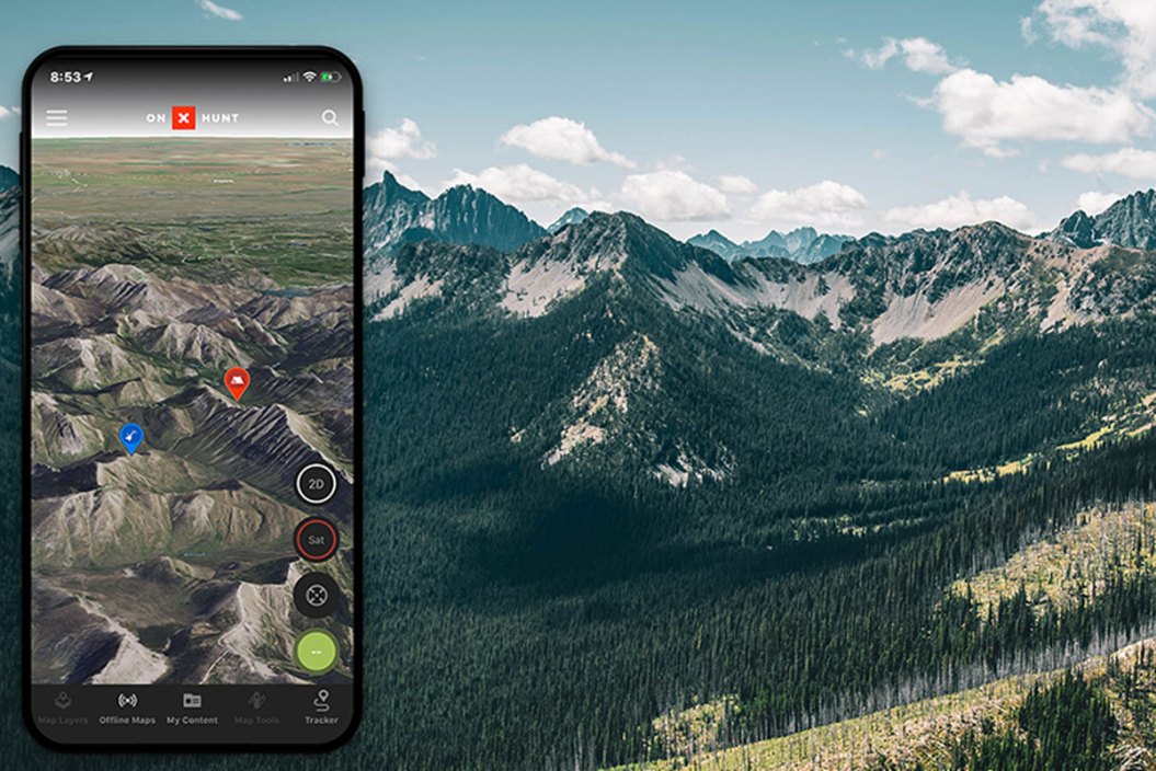
I was first drawn to the onX Hunt app because it changed the way I use mapping tools. The mere ability to mark GPS locations straight from the handiness of your phone was a huge benefit. From there, I continued to explore the features and found plenty to like. There are so many aspects of the onX application worth raving about, but the latest development trumps them all: 3D mapping.
If you've ever maneuvered your way around Google Earth, you may have seen this type of feature before. Taking it a step further, onX brings us higher-quality 3D images that allow you to mark locations for later offline reviewing.
When I was in the Uncompahgre Forrest of western Colorado, I was able to precisely navigate myself and a hunting partner to a glassing knob way off the trail by simply setting a waypoint. And, the 3D mapping made it feel as though we had the luxury of flying a drone to see every inch of the entire hunting unit.
And, even when we were completely off the grid with no service, we were able to count on topo offline maps were still accessible on my iPhone and still completely reliable.
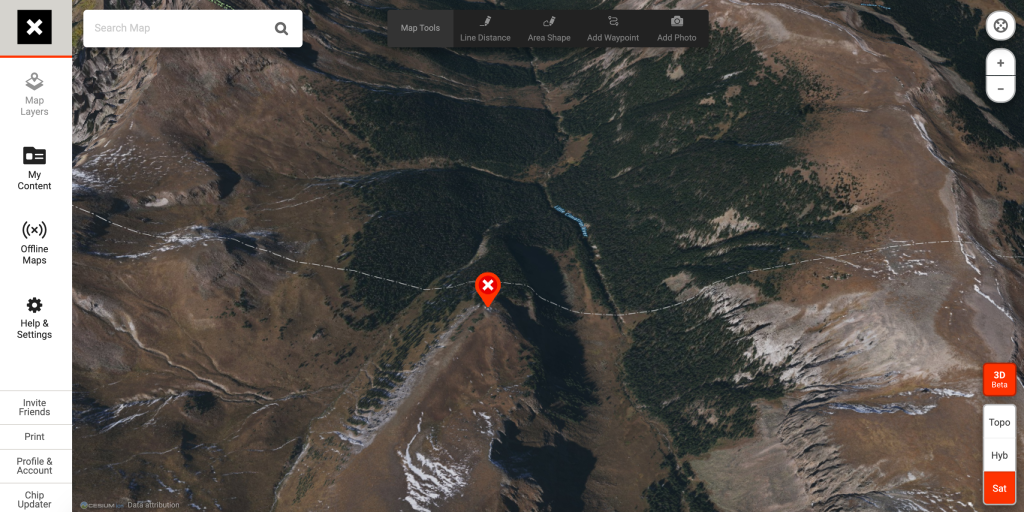
Although we didn't see much from the knob, we would have never been able to get to this point so easily without the help of our aerial Basemap on the app. In fact, there were several instances during which we were able to e-scout before hitting the trail to make more hour-by-hour decisions on hunting spots and our route to get to each.
Collectively, onX Hunt maps encompass 985 million acres of public land and more than 121 million private properties. The app also offers several layers to overlay onto your map to find property boundaries, migration corridors and even elevation barriers.
As of right now, in order to provide the best picture quality, you can't use these layers in conjunction with 3D maps. Also, 3D is not yet available for Android devices, and can only be accessed by Apple iOS operating systems or the web app.
Granted, other apps have similar 3D features, but since onX Hunt released their version, I haven't been able to find one I like more. Tools like these allow you to envision something you just can't see by packing down any trail.
These innovations can transfer well into smaller, more familiar plots of ground, too. I've used it to follow creek beds and boundary lines for public and private lands, as I try to gain every advantage I can over the whitetails that frequent my stand in West Texas.
With years of expertise backing up the technology, an app like this pays for itself.
For those interested in finding out for themselves, subscription prices for a Premium Membership are $29.99, and an Elite Membership is $99.99.
Overall, the use of 3D mapping is priceless for hunting the backcountry. You have the ability to see the terrain from the comfort of your home months before your boots hit the trail. And, the more preparation before hitting the field, the better.

NEXT: WHAT ARE THE BEST DEER HUNTING TIMES THROUGHOUT THE DAY?
WATCH