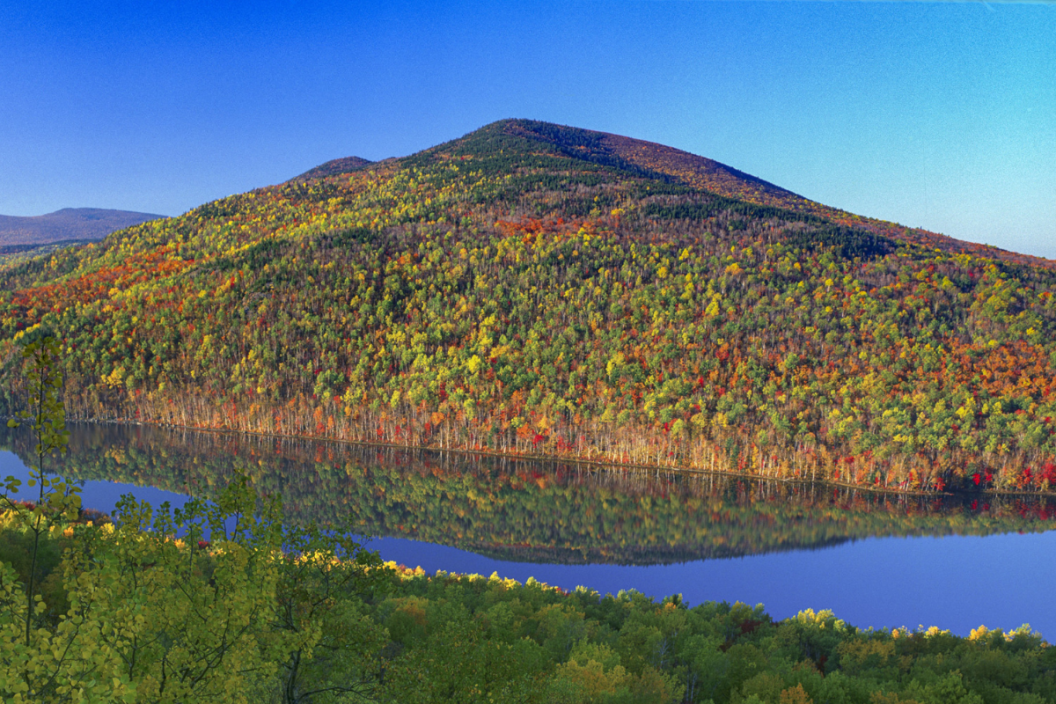
Located in north-central Maine and considered the Appalachian Trail's Northernmost point, Baxter State Park offers over 209,000 acres of native wilderness to explore. Nestled in the town of Millinocket in Piscataquis County alongside the Katahdin Woods and Waters National Monument. The park boasts the tallest mountain in Maine, Mt. Katahdin, a wide array of water sources such as waterfalls, ponds, lakes, and streams, as well as a large selection of wildlife.
To visit Baxter State Park, fly into Bangor or Portland, Maine, or even Quebec City. Or take a scenic drive from wherever you happen to be! To attach another incredible park to your trip, add Acadia National Park to your itinerary.
History of Baxter State Park
https://www.instagram.com/p/CHQhCtNAp3s/?utm_source=ig_web_copy_link
The history of Mt. Katahdin, or "The Greatest Mountain" region, first begins with the Penobscot Indians who named the mountain. To the native peoples of this land, the mountain is a special source of spiritual enlightenment and a representation of the beginning of life. The Penobscots feared that at the peak of the mountain, an evil spirit named Pamola resided and would kill them if they summitted Katahdin.
Fast forward to the 1800s when the Commonwealth of Massachusetts asked Charles Turner Jr. to conduct a survey of the northeast corner of the United States, which included this mountain. Turner had two Native American guides lead he and a small group to the summit. Turner and his crew continued to the top while the guides stayed back as they had warned about Pamola many times. Turner and his group successfully made it to the top of the mountain on August 13, 1804, as the first non-Native ascent of Katahdin.
During the years 1921 and 1924, the governor of Maine was Percival P. Baxter. He was raised in the state and grew a strong affinity for the land. A lifelong dream of his was to create a park for the State of Maine. In the year 1930, he purchased almost 6,000 acres which included the highest peak in Maine, Katahdin. He then donated the land parcel to the state with one agreement — that it stay forever wild.
Throughout the following decades, he continued to buy surrounding lands and started to piece together what is known today as Baxter State Park (BSP). Today, approximately three-quarters of the park is managed as a wildlife sanctuary and the rest is managed by the Scientific Forest Management Area. A quarter of the park is allowable for hunting and trapping (except for the precious moose).
Things To Do at the Park
https://www.instagram.com/p/CMujY6Qh69e/?utm_source=ig_web_copy_link
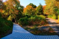
Complete with over 215 miles of trails and 40 peaks and ridges, Baxter State Park is a home base for hikers, climbers, bikers, hunters, and nature lovers. There are eight roadside campgrounds and two backcountry areas for campers to stay overnight in the park. Visitor counts reach approximately 60,000 people in the summer months. Although we do not know for sure, we can guess that most come to see the northern terminus of the Appalachian Trail (A.T.).
Hiking at BSP

RELATED: "Georgia's Little Grand Canyon" Leaves Explorers Speechless
Baxter State Park is a hiker haven for those who love to trek on their own two feet. With over 200 miles of trails to be explored, the trail list is extensive. The park's website has a detailed trail guide with lots of amazing information for all of the different types of hiking trails you can discover while at the park.
The shortest route to Baxter Peak is the Abol trailhead where you traverse the west side of the slide on a short but very steep trail with incredible views. One of the more popular options to summit Mt. Katahdin is the Hunt trail. This trail offers beautiful views of Katahdin Stream Falls, the Tableland, and the majority of this trail sits above the treeline making for excellent views.
To reach Pamola Peak, take the Helon Taylor trail from the Roaring Brook trailhead that merges with the Knife Edge trail and heads up the peak. Please note that this trail is dangerous during bad weather. Another way to reach Pamola Peak is to take the trailhead that leaves from Chimney Pond campground and gains almost 2,000 feet on a 1.3-mile one-way trek.
For some easier day hikes, consider starting at the Togue Pond Gate or the Matagamon Gate. From the Togue Pond Gate, you can visit Cranberry Pond or Caverly Pond and even rent a canoe to view the park. From the Matagamon Gate, you can take the Horse Mountain trail or discover Trout Brook off of Tote Road.
Important Information
https://www.instagram.com/p/CL2V9lnhXrj/?utm_source=ig_web_copy_link
If you plan to visit this New England gem, be sure to stop by the park headquarters if you want to talk to the park rangers or need more information for your trip. Due to higher demand in the summer as well as on weekends, it is advised to make a car reservation for parking lots.
Be sure to come prepared, as many areas of the park do not have running water or outhouses. Whether you are camping or just buying a day-use pass, it is imperative that you arrive with everything you might need for your adventure.
As far as camping goes, Baxter State Park features many different options for staying overnight in both the winter and the summer. There are cabins at Kidney Pond and Daisey Pond, campsites at the North End at Nesowadnehunk Field, South Branch Pond, and Trout Brook Farm, as well as backcountry options for those looking to be more off-grid. More information can be found from Friends of Baxter State Park or the Baxter State Park Authority.
Have you visited Baxter State Park? Tell us about it on the Wide Open Roads Facebook Page!