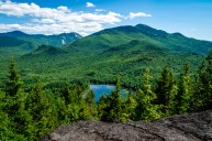
Colorado's legendary peaks above 14,000 feet—better known as 14ers—often steal the hiking spotlight in the mountainous state. But there are actually 637 peaks in the state between 13,000 and 13,999 feet that are largely overlooked even though they're just as challenging. What's more, they're often way less crowded, which is a serious win considering Colorado's 14ers have become almost unbearably popular.
Colorado's 13ers may not have the same prestige as their taller brethren, but these peaks offer stunning views and challenging climbing routes.
If you're looking to explore these ruggedly beautiful mountains, lace up your hiking boots, pack your gear, and check out these impressive peaks.
Decoding the Grading System
First things first: Before you venture out, you should know the difficulty of your hike so you're adequately prepared for the trail. Within the mountaineering world, peaks and trails are rated by access, distance, steepness, and overall terrain. Keep in mind, these ratings don't account for ice, snow, or winter conditions.
In the United States and Canada, the Yosemite Decimal System has been used to rate mountains and long-distance hikes since the 1950s. First devised by the Sierra Club in the 1950s, it's broken down into three parts that rate the difficulty level of walks, hikes and climbs.
There are five classes, with Class 1 being the easiest and Class 5 being the most difficult, and knowing which you're getting into is helpful to plan a safe hike. For the case of Colorado's 13ers, we'll just look at the first three classes:
Class 1: These hikes are usually easy trail walking or cross-country travel with few to no route-finding difficulties, obstacles, or terrain features. You will gain elevation, but you won't require technical equipment to hike.
Class 2: These hikes will be more challenging. They're still basic hikes but they may involve going off-trail, and you may encounter reasonably stable and small to moderate-sized talus and talus slopes, and stream or creek crossing.
Class 2+: These hikes will involve all of the items in Class 2 plus they will be more difficult, with less stable talus at higher angles, rubble, and boulder fields that may require stabilizing your walking with occasional hand holds and hiking supports like trekking poles or ice axes. Route finding may become even more difficult with these hikes. Talus-type slopes may become so steep that you'll take two steps forward and slide back one. Moderately pitched snowfields may be included that require an ice axe for safety but not necessarily crampons. The term "scrambling" is often used for such terrain, because of the use of hands with various instruments to maintain stability.
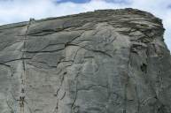
Class 3: Class 3 hikes start to get serious because there are areas that will involve some scrambling. You'll be looking for and using handholds for upward progress and will literally be "climbing" at some points rather than just walking upward. We most frequently encounter this terrain when passing through areas of large boulders that must be surmounted or descended with a brief climbing move involving both hands. There may be some low to moderate and brief exposure, but it's unlikely you'll need to use a rope.
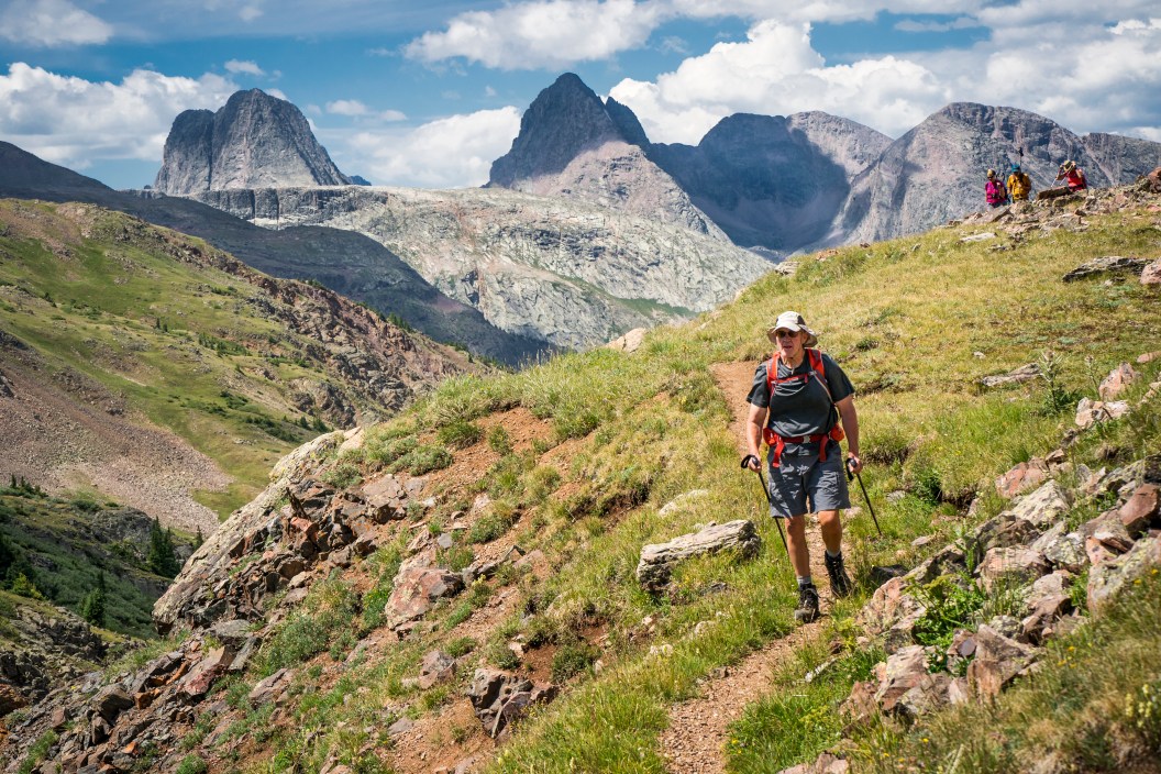
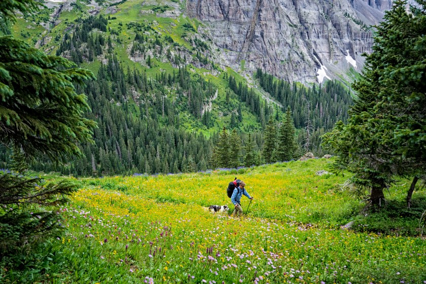
What To Know Before You Hike a 13er
Cleardesign1/Getty
When to Climb
Most peaks above 8,000 feet are usually covered in snow from late Fall to late Spring so the best time to plan a trip is between Memorial Day and Labor Day. This will ensure fairer weather and warmer temperatures.
Be sure to start early in the day (like, before sunrise): In the summer, afternoon thunderstorms with severe thunder and lightning are quite common and very dangerous when you're that high and exposed. Plus, getting to the trailhead early helps avoid parking crowds and gives you ample time to ascend and descend back to the parking lot.
Looking ahead at the weather forecast and packing correctly is essential for a successful and comfortable trip.
Pace Yourself
Remember: There's less oxygen the higher you go, which affects everything from your breathing to your energy levels and muscles. For every 20 minutes of movement, stop for a 5- to 7-minute break to hydrate, check in with your breath, and monitor your pulse and feet. For every 100 feet of ascent, take a 20-minute break. This is also a great time to have a snack to refuel for the rest of your hike.
Be mindful of the altitude gain if you are new or visiting Colorado; altitude sickness is a very real thing.
Be Prepared
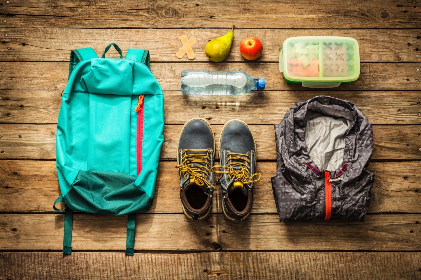
Before you go, determine how long (distance and time) a hike you want to do. You should also factor in the drive to many 13er trailheads because they can be pretty remote. Always check the weather and pack extra layers just in case.
You should also plan out the trailhead access, elevation gain, and total round-trip mileage for your hike and make sure that all hikers in your party are well aware of the itinerary. One mile of mountaineering takes longer and more effort than walking a mile on a hike trail or treadmill. Obviously, this varies based on your endurance, and stamina, so know your fitness level and train accordingly.
Get plenty of rest the night before, and refrain from a late night of alcohol. This will ensure that you are in full vigor and optimal health capacity to take on the long hike.
READ MORE: The Best Hiking Backpack, Chosen By An Experienced Hiker
The Best Beginner 13ers to Climb in Colorado
Getty Images, Adventure_Photo
Among the 637 peaks above 13,000 feet, these are six we love for beginners. They are all Class 1 or Class 2, and all the mileage listed is round-trip.
1. Rosalie Peak, Mount Evans Wilderness
Class: 1 | Elevation: 13,575 feet | Distance: 10.5 miles
Rosalie Peak is the 207th-highest peak in Colorado. A convenient drive from Denver, you can get to the Deer Creek Trailhead in an hour. This hike has longer mileage and a beefy elevation gain, but it's an overall pleasant grind with wildflowers and breathtaking views. On a clear day, you can see Pikes Peak, the Lost Creek Wilderness, and the Crestones from the top.
2. Mosquito Peak, Mosquito Range
Class: 1 | Elevation: 13,781 feet | Distance: 5.7 miles
The Mosquito range is better known for its extensive mining history, and the drive from the Denver/Boulder area is about two hours. The Class 1 route is simple and the hike is over mostly smaller scree and rubble, grassy slopes, with a few easy rocky sections at the top. You'll have lake views with many many wildflowers along the way. This range is always windy, so dress appropriately.
3. Mount Sniktau
Class: 1 | Elevation: 13,240 feet | Distance: 3.7 miles
Short and sweet with expansive 360-degree views of the Continental Divide, this great beginner peak has a gentle grade and is slightly steeper at the ridge line. With easy access and approach, this hike starts at Loveland Pass only an hour outside of Denver. This hike can be completed in under three hours but don't be tricked by the false summits on this one. This hike can overall be quite challenging for the novice hiker, so pace yourself accordingly. The views along the trail provide a scenic t look at A-Basin, Torreys Peak, and the surrounding Front Range mountains.
4. Hoosier Ridge, The Mosquito Range
Class: 2 | Elevation: 13,352 feet | Distance: 2.5 miles
One of the three massive humps outside of Breckenridge, Hoosier Ridge is best traveled as a counter-clockwise loop, with some steep hair-pin switchbacks along the way, but overall it has a consistently graded ascent to the summit.
5. Gray Wolf Mountain, Mount Evans
Class: 2 | Elevation: 13,602 feet | Distance: 5.25 miles
Gray Wolf Mountain is visible from Denver as a summit just poking over the shoulder of Rogers Peak. There are three potential ways to access Gray Wolf Mountain, but the easiest is accessed by the Summit Lake Trailhead and takes an average of 6 hours and 23 minutes to complete. There are a few false summits, but there are amazing views throughout. The trail becomes difficult to follow around the 2-mile mark, but it is definitely one less traveled.
6. Mount Audubon, Indian Peaks Wilderness
Class: 2 | Elevation: 13,223 feet | Distance: 8 miles
Start this trail from the Brainard Lake Recreation Area in the Indian Peaks Wilderness, just north of Ward, CO. The hike is best accessed from the Mitchell Lake Trailhead to Mt. Audubon trail, and it's clearly not for the novice or faint-hearted. Even though the ascent is gradual, the majority of the hike is above the tree line, and the last half mile is a steep incline over lots of loose small to large rocks.
READ MORE: The 4 Best Places to Camp in Colorado for Outdoor Adventure