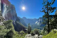
Eight months ago, I traded the bustle of New York City for the slower pace and warmer climate of Austin, Texas. In addition to the roomier living quarters and Texas-style BBQ, I've been taking advantage of the plethora of hiking trails in and around the Lonestar State's capital city. Not only do these trails offer some breathtaking views of the city's skyline, they also cater to hikers of all skill levels.
Having explored these trails extensively, I'm thrilled to share some of my favorites. These pathways have become my sanctuaries, providing a natural escape from the concrete and traffic of city life. Whether you're looking for a serene afternoon trek or a more adventurous hike, Austin's hiking scene has something for everyone. These top 10 best hiking trails in Austin—ranked by difficulty—have made my introduction to Texas living truly memorable.
Easy Hikes in Austin
Kayla Hui for Wide Open Spaces
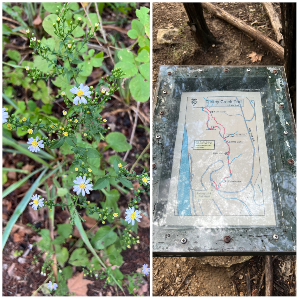
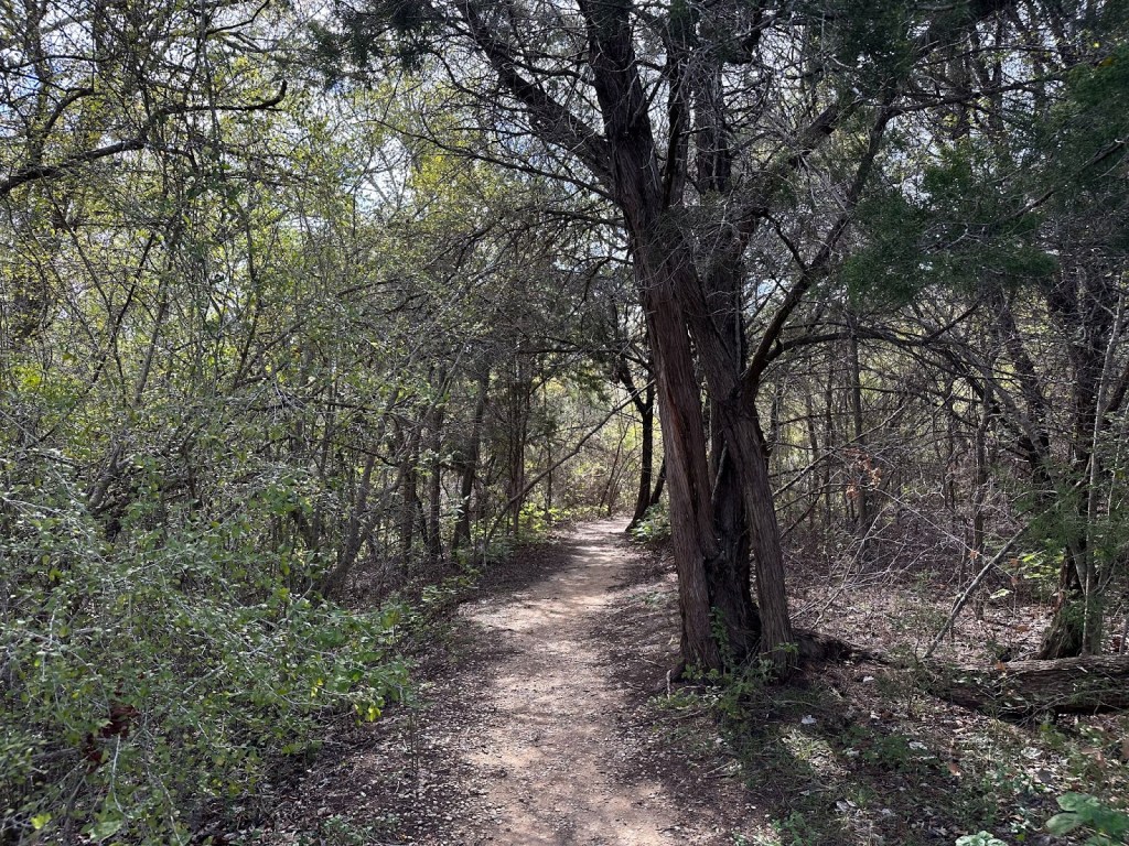
1. Turkey Creek Trail
- Length: 2.7 miles
- Elevation gain: 209 feet
- Route type: Out and back
- Average completion time: About an hour
- Best place to access trailhead: Left onto City Park Road and south to the Emma Long Park entrance sign
Open year-round, Turkey Creek Trail at Emma Long Park along the western part of the creek is an easy stroll and a great escape from the city during mornings, afternoons, or weekends. Also to love? There's ample shade to shield you from the blazing Texas sun.
Turkey Creek Trail is popular among families and couples, so you can expect to see some friendly faces heading in and on your way back. It's also dog-friendly, and off-leash is acceptable. I went on a Saturday afternoon, and the trail wasn't crowded. There was plenty of parking available in the gravel parking lot, which holds roughly 20 cars.
For this one, you're going to want to bring a grippy pair of sneakers or hiking boots. The 2.7-mile out-and-back trail takes roughly an hour to complete, and during your hike, you'll step over rocky and slippery terrain. I went the day after it rained, and I noticed that parts of the trail were slippery and muddy. I was fine—my shoes...not so much. If you decide to go when the ground is wet, bring along plastic bags, paper towels, and other cleaning materials to get the mud off your shoes.
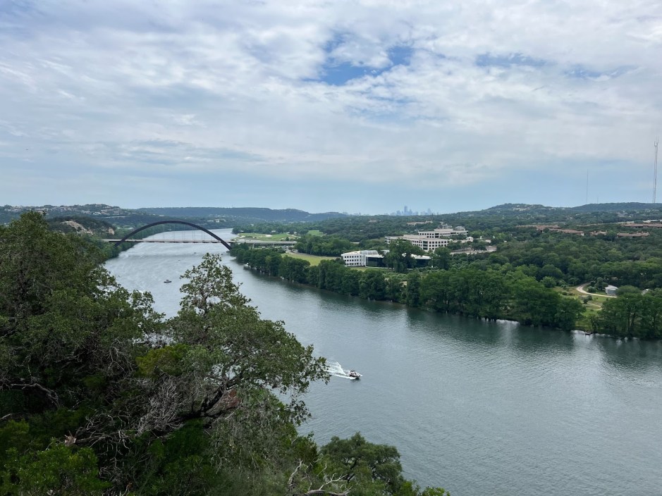
2. Lake Austin / 360 Bridge Overlook
- Length: 0.5 miles
- Elevation gain: 42 feet
- Route type: Out and back
- Average completion time: 11 minutes
- Best place to access trailhead: Parking lot located on North Capital of Texas Highway
If you're looking for a no-frills route, look no further than Lake Austin's 360 Bridge Overlook. This out-and-back route only takes about 10 minutes and is just half a mile in length. To get to the top, you'll have to hike up several large rocks, so wear your grippy-soled shoes. I didn't find it challenging on the way up but had to grab the rocks to steady my footing on my way down.
Yes, it's a short hike, but what makes this route worth your time is the panoramic views of Lake Austin and the 360 Bridge. This spot is a must-visit for all, especially first-timers in Austin or visiting friends or family.
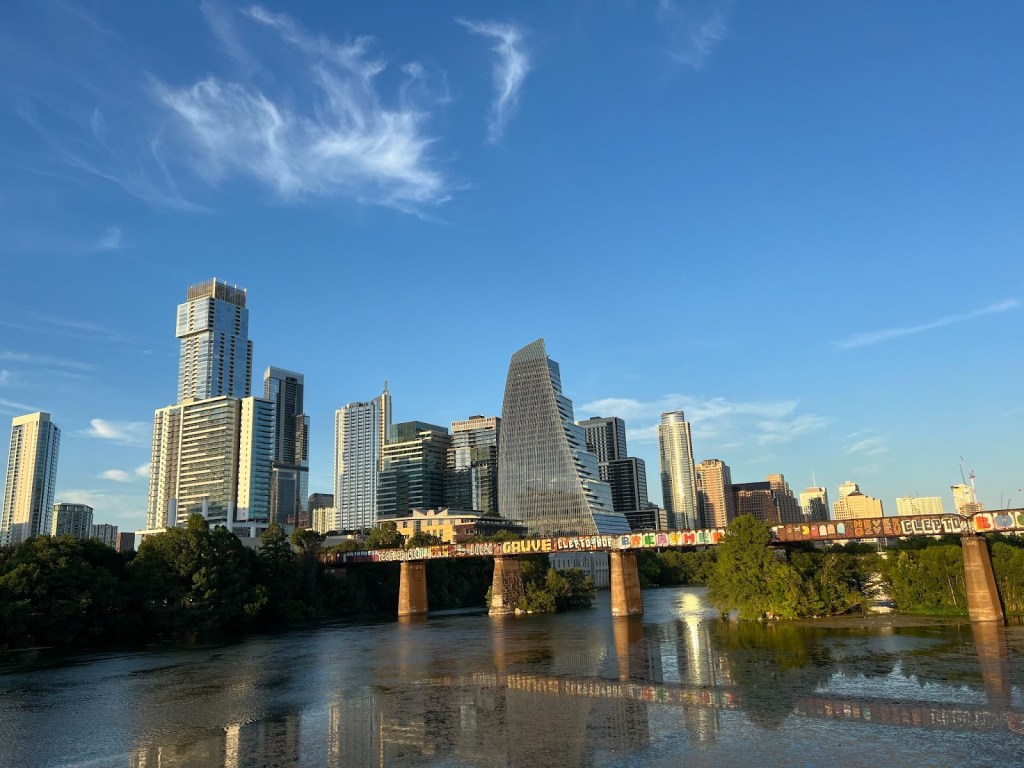
3. Ann and Roy Butler Hike-and-Bike Trail
- Length: 10 miles
- Elevation gain: 246 feet
- Route type: Loop
- Average completion time: Just over 3 hours
- Best place to access trailhead: Near Butler Shores at Town Lake
The Ann and Roy Butler Trail is a fairly easy loop trail around Lady Bird Lake, in downtown Austin. Despite being 10 miles long, the trails are mostly gentle, making this a great choice for both walkers and runners, and it's fully paved to accommodate cyclists, rollerbladers, strollers, and wheelchairs as well. If you tackle the trail counterclockwise, you'll reach the steepest part roughly 9.5 miles in. If you're using a wheelchair or stroller, additional assistance may be needed to crest it.
What I love about this trail is the blend of views of downtown Austin and nature. Throughout, you'll spot skyscrapers, lush foliage, and the occasional kayakers and paddle boarders beneath the Austin Graffiti Bridge.
4. Twin Falls and Sculpture Falls via Barton Creek Greenbelt
- Length: 3.2 miles
- Elevation gain: 124 feet
- Route type: Out and back
- Average completion time: Just over an hour
- Best place to access trailhead: The trailhead is situated along Loop 360 Mopac at 3755-B South Capital of Texas Highway
When I first moved to Austin, the Barton Creek Greenbelt in Southwest Austin stood out as the top recommendation. This 3.2-mile out-and-back trail is fairly easy to hike and takes roughly an hour to complete, with nice terrain variation along the way, from rooted paths to rocky ledges. It can get slippery at times, so I'd recommend wearing kicks with traction.
If you're lucky—or you go after a good rain in the spring or fall—you'll get a glimpse of the waterfall, but during the summer, it dries up. For the most part, the trail is pretty level, with a few points of rapid elevation change. This trail suits dogs on a leash, kids, and all outdoor enthusiasts who enjoy an easy but diverse trail.
5. Blunn Creek Greenbelt Trail
- Length: 1 mile
- Elevation gain: 82 feet
- Route type: Loop
- Average completion time: About 20 minutes
- Best place to access trailhead: Street parking along St. Edwards Drive
The one-mile loop trail is a must-visit for a quick afternoon stroll. The Blunn Creek Greenbelt Trail leads you through canopied trees, creek crossings, and rocky terrain all while offering views of downtown Austin and St. Edward's University. Because it doesn't attract as many visitors compared to other trails on the list, it's a lovely spot to go if you're looking for some peace and quiet.
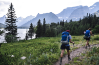
Moderate Hikes in Austin
Kayla Hui for Wide Open Spaces
6. Onion Creek Trail via McKinney Falls State Park
- Length: 6.8 miles
- Elevation gain: 387 feet
- Route type: Loop
- Average completion time: 2 hours, 20 minutes
- Best place to access trailhead: 57GF+472, Austin, Texas, 78744
If you're looking for a longer route, I'd recommend Onion Creek Trail in McKinney Falls State Park. The loop trail runs 6.8 miles with plenty of picnic tables and benches for resting. Pack a lunch and some light snacks if you decide to spend a day exploring.
The trail took me roughly 2 hours and 20 minutes to complete and is mainly paved asphalt with some uneven bumps and cracks, making it mostly wheelchair- and stroller-friendly. This is a good choice for adventure enthusiasts who like to venture off to other trails from the main route.
7. Three Falls Hike
- Length: 7.3 miles
- Elevation gain: 275 feet
- Route type: Out and back
- Average completion time: 2 hours, 20 minutes
- Best place to access trailhead: South Mopac Frontage Rd from the SH-360 Loop exit on Capital of Texas Highway
As fall envelops Austin with cooler temperatures, the appeal for Three Falls Hike grows stronger. Because the falls dry up, you can expect fewer crowds compared to the summer months. Still, you can expect the trails to be busy during weekends in the autumn with local hikers who are looking to take advantage of the crisper weather. Totaling 7.3 miles, this out-and-back trail offers both the option to clock in the miles and scramble over rocks, complete with challenging, steep offshoots.
I noticed a lot of sections without trail markings, so make sure to download AllTrails or a preview of the map before your hike. This helped me navigate the trail with more confidence while enjoying the scenic views.
8. Homestead Trail
- Length: 3.4 miles
- Elevation gain: 160 feet
- Route type: Loop
- Average completion time: Just over an hour
- Best place to access trailhead: 5808 McKinney Falls Parkway
This intermediate loop is 3.4 miles long and overall is fairly flat and marked well. There's a part of the Homestead Trail that requires you to hop the stream and navigate some slippery terrain, so I wouldn't recommend it to folks who are not in good physical shape or are unsure on their feet. There's also poison ivy along some trail spots, so longer pants or leggings are recommended.
Still, Homestead Trail is totally worth the trek. Along the route, you'll spot wildflowers, a waterfall, and occasionally some butterflies that pass through. If you're looking for a moderate hike and want to be surrounded by foliage, this one should be on your to-hike list.
Hard Hikes in Austin
Kayla Hui for Wide Open Spaces
9. River Place Canyon Trail
- Length: 5.4 miles
- Elevation gain: 816 feet
- Route type: Out and back
- Average completion time: About 2.5 hours
- Best place to access trailhead: 4998 River Pl Blvd, Austin, Texas, 78730
Along the 5.4-mile, out-and-back River Place Canyon Trail, hikers can expect shaded trails with exposed roots and beautiful rock formations. During much of the year, you'll have to cross through a creek, so I'd recommend waterproof or water shoes. In the summer months and early fall, this part of the hike is dry, so you'll be able to cross without getting your feet wet. Along the western side of the loop, you'll find bathrooms, as well as water.
During peak hours on Saturday, Sunday, and holidays, this hike has a daily fee of $10 per hiker, and attendants at the trailheads collect payment—children under 12 who are accompanied by an adult hike for free. To skip the weekend crowds (and the fee), I'd recommend going on a weekday. Either way, this trail is worth the hike; it offers views of beautiful waterfalls, bluebonnets, and other foliage.
10. Barton Creek Greenbelt Trail
- Length: 14.2 miles
- Elevation gain: 718 feet
- Route type: Out and back
- Average completion time: 5 to 6 hours
- Best place to access trailhead: There are several entry points, including the Barton Spring Pool, Spyglass Access (Off of Barton Hills Drive), and Loop 360 (right off of Capital of Texas Highway).
The Barton Creek Greenbelt is the go-to trail for avid hikers and athletes. The 718-foot elevation gain and total length of 14.2 miles aren't the only challenges; along the way, the trail can be rocky and rugged.
The Greenbelt travels along the creek, so you might spot wildlife like songbirds, lizards, and frogs. Like many other trails, the creeks can dry up during the warmer months, so if you're keen on seeing water flow, visit during late fall or winter. If you grew up or live in the city, you might be shocked to find that this wild space exists right under our noses.
If planning to complete this route, I'd recommend starting early in the morning and packing lunch, snacks, and plenty of water, as this hike can take between five and six hours. When hiking in the summer, wear your suit for a cooling dip in the various swimming holes, such as Campbell's Hole and Sculpture Falls.
READ MORE: 10 Reasons to Visit Austin, Texas